
Trace Santa Clarita Street Directory by Address
An address-led Santa Clarita street directory search is a chain, not an open name list. Match the address to a county parcel and the City's Mapping Your City viewer. Preserve AIN/APN, tract/lot, legal description, and jurisdiction. Historical directories add clues; voter tools validate personal status or permitted file data.
Keep each result tied to its source: assessor omits owner and mailing identity, permits may show participants, and GIS maps parcels.
- Fix the address. Preserve house number, unit, street spelling, ZIP, and any older community label.
- Anchor the parcel. Search the Assessor by address, AIN, or legal description, then compare with Santa Clarita City GIS.
- Bring a known deed party. Use a name already tied to the property lawfully; never turn an omitted owner field into a residence claim.
- Walk the Norwalk trail. Use the known party and year at RR/CC, note the grantor, instrument, and legal description, then move backward.
- Apply voter limits. Use the status form for personal verification. A paid file requires a permitted purpose and contract.
- Add the reverse directory. Check discrete years by street or address, comparing old names, maps, and legal descriptions.
Santa Clarita Street Records at a Glance
Santa Clarita street research crosses city, county, state, and local-history custody. The City handles permits; Los Angeles County handles assessment, deeds, taxes, and elections. Libraries and SCVHistory preserve directories and maps. Each row is a lead, not proof.
| Record Set | Keeper | What It Shows | Access |
|---|---|---|---|
| Parcel assessment | LA County Assessor | AIN, situs/ZIP, use, years, values, legal description, zoning, flags | Free by address, AIN, or legal description; no owner browse |
| Parcel map | Santa Clarita City GIS | Site/unit, ZIP, tract/lot, districts, annexation, year built, legal description, adjacent polygons | Free viewer; owner and mailing identity absent |
| Deeds and liens | LA County RR/CC | Grantor, grantee, instrument, legal-description chain | Norwalk appointment, mail, phone information, copy orders |
| Permits and cases | Santa Clarita Permit Center | Type, status, address, dates, description, inspections, applicant, contractor | Limited web access, account, counter, or CPRA request |
| Voter status or file | LA County Registrar-Recorder | Personal status or permitted file fields | Personal form or paid contract; no street browse; confidential voters suppressed |
| Reverse directories | SCVHistory and libraries | Subscriber, resident, or business leads for discrete years | Digital or reference access; incomplete coverage |
Note: AIN and legal description bridge parcel, map, deed, and permit layers; preserve a silent row instead of adding a household assumption.
Search Santa Clarita Street Directory Portal
The Los Angeles County Assessor Portal is the parcel starting point for a Santa Clarita street directory. It accepts one text entry in Search by AIN or Address or Search by Assessment Legal Description. An exact address or ten-digit AIN works best. Broad queries may cap at 501 results, with no export observed. There is no owner-name browse, and public detail omits owner identity and mailing address.
Use these controls to narrow land, not people. When a street label changes, carry the legal description, AIN, tract, lot, and situs ZIP into City GIS and Norwalk.
| Field or control | Type | Required | Format and behavior |
|---|---|---|---|
| Search by AIN or Address | Tab plus single text | Yes | Exact address or ten-digit AIN works best. |
| Search by Assessment Legal Description | Tab plus single text | Yes | Alternative legal-description mode. |
| Search | Button or icon | Not applicable | Broad queries may cap at 501 results; no export observed. |
Results lead to AIN, address, and legal description. The City Hall AIN 2861026900 detail shows the record a street search can inspect.
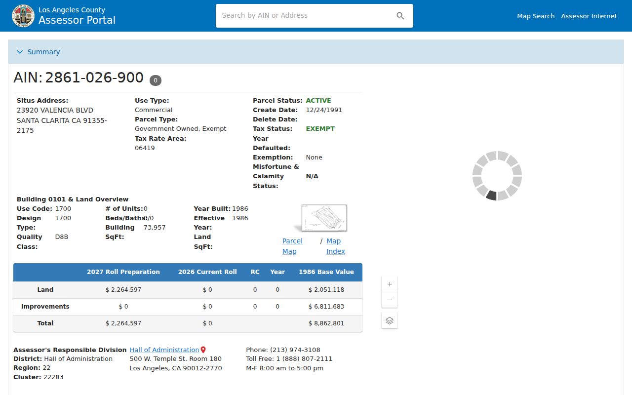
The sample includes AIN, coordinates, situs/ZIP, use, units, built/effective year, areas, values, legal description, zoning, and flags. It identifies government-exempt City Hall at 23920 Valencia Boulevard, built in 1986, tract 33746 lots 3 through 5. Owner identity and mailing address are absent, so the detail is land evidence, not a resident roster.
Carry the AIN and legal description forward; do not force a name search into the portal.
Separate Santa Clarita Address Terms
Address research is clearer when parcel language stays distinct from household language. A situs address identifies the assessed site; a mailing address is the tax-notice destination; a plat or legal description identifies mapped land. A criss-cross directory is a historical address tool, not a current roll.
- Parcel
- Defined land tracked across assessment and map systems by an AIN or APN, legal description, and site facts.
- Situs address
- The physical address assigned to the assessed site, not an owner's tax-mailing destination or proof of occupancy.
- Plat
- A subdivision or tract map laying out lots, streets, and recorded land relationships used to test an older address.
- Criss-cross directory
- A reverse directory arranged by street or address that connects a historical site to a subscriber, resident, or business lead for one year.
Note: Preserve old printed wording separately from modern situs wording so a historical directory clue stays tied to its proper time.
Tax inquiry is a companion to the parcel record, not a substitute for a deed chain. The Los Angeles County public tax inquiry provides a separate current-tax route when a street search needs a second county source.
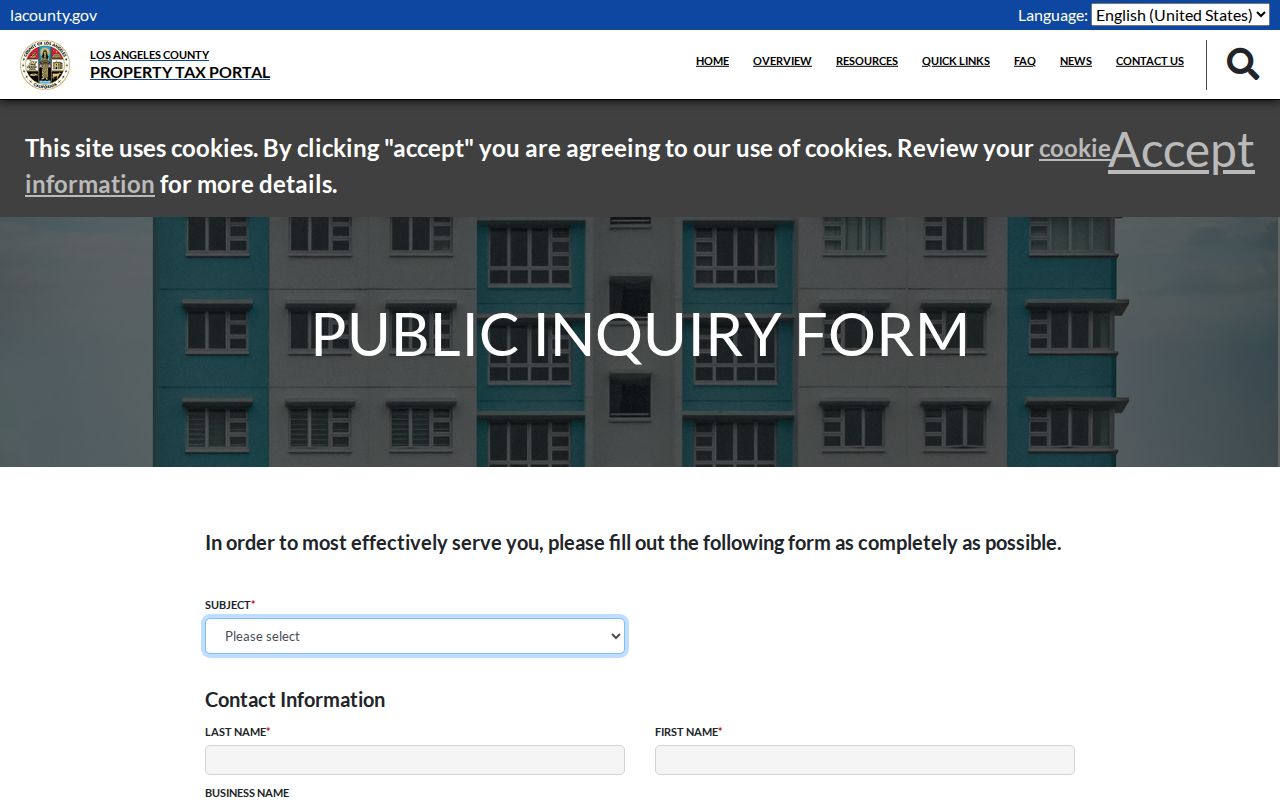
Keep the tax result's parcel reference and tax year separate from the situs address and from any historical directory entry. A tax mailing destination is not proof of occupancy, and a tax page does not replace the RR/CC name-and-year index.
Map Santa Clarita Streets by Address
Santa Clarita's Mapping Your City viewer supports Search by Address with ST_NUM, ST_NAME, FULL_STNAM, BLDG_ADRES, and STNUM_UNIT. It also offers APN, tract-number, and intersection modes. Address, APN, and tract searches return up to six suggestions or results; intersection search offers up to ten suggestions and six results. Results can show AIN/APN, site/unit, ZIP, jurisdiction, tract/lot, House Numbering Map, flood, landscape, and streetlight districts, annexation date, water and zoning codes, trash, sewer, and fire, year built, sheriff zone, acreage, legal description, prior parcel, and council district. Owner and mailing fields are absent.
Use Buildings, HOA, Site Address, Parcel Number and Outlines, easements, parks, schools, districts, facilities, and one-mile layers as needed. Parcel Outlines appear at about 1:12,000; Parcel Number at about 1:1,800. Zoom, select the target, and select adjacent visible parcels. The city viewer has no configured radius or buffer tool.
The Los Angeles County Assessor parcel map provides a useful visual companion for panning, parcel outlines, and adjacent parcel clicks.
Confirm the expected block. Nearby polygons are nearby parcels, not a verified list of Santa Clarita neighbors or household members.
Date Santa Clarita Street Changes with Permits
Santa Clarita Accela eService adds an address-and-time layer. Its tabs include Property Information; Building application, search, and inspection tools; Licenses search and renewal; and Environmental Services application search. Controls accept record or application number, street number and name, parcel number, and start and end dates.
Results may show record number and type, status, project address, application and issue dates, description, inspections, and applicant or contractor contacts. These document a project, not residence.
The Accela screenshot shows that address search surface.
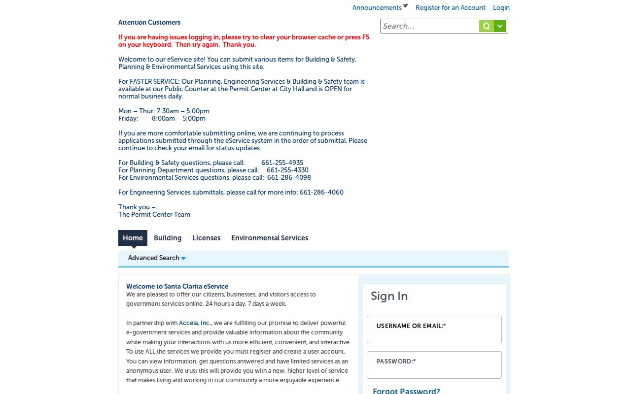
Anonymous viewing is limited; registration is required for all services. The Permit Center counter is open Monday through Thursday 7:30 a.m. to 5:00 p.m. and Friday 8:00 a.m. to 5:00 p.m. Building and Safety is 661-255-4935, Planning 661-255-4330, Engineering 661-286-4060, and Environmental Services 661-286-4098.
For an unpublished city file, the City Clerk CPRA channel can target date range, department, address, permit or case number, and format. Code complaints may redact complainant data, so request the address-keyed log, dates, category, status, or final notice. CPRA seeks an existing record, not a new list or answer.
Follow Santa Clarita Address Deeds
Los Angeles County RR/CC keeps real-estate records from 1851 to present, but no public online index or images. Review is by appointment at 12400 Imperial Highway, Norwalk: 1851–1957 on the lower level and 1958–present on the second floor. Indexes are alphabetical by name plus year, not street or APN. Phone index searches are not accepted.
Call 800-201-8999, option 2 for property recording or option 3 for recorded records. At the counter, find a grantee's acquisition, note grantor, instrument or book-page reference, and legal description, then search that grantor as grantee earlier. A deed party is a chain link, not proof of occupancy.
The viewing instructions explain appointments. Mail or fax the document title, names, and year or years to RR/CC Real Estate Records, PO Box 1130, Norwalk, CA 90651-1130, with check or money order. The county reports 20 working days and no phone request. Plain copies are $5 first page plus $3 per page; certified copies are $6 first page plus $3 per page; a name-and-year search is $0.50 per name and year, $1 minimum. Use the mail instructions and fee page before payment. Online copy ordering is not a deed index.
Note: Online copy ordering is not a deed index; when the goal shifts to one person, use the Santa Clarita resident lookup workflow.
Read Santa Clarita Streets Through Time
Santa Clarita incorporated in 1987 at 39.79 square miles and has grown through more than 30 annexations. Pre-1987 records use Los Angeles County and older community names. Keep jurisdiction, annexation date, legal description, and historical wording separate.
Crosswalks:
- Spruce Street was realigned in the 1920s, became San Fernando Road, and the downtown segment became Main Street in 2007.
- Tenth Street and Pico Road became Lyons Avenue.
- Fir became Walnut, and Maple became Chestnut.
- Newhall town and depot moved about two miles south in January 1878 toward water.
Verify an old address with maps and legal descriptions instead of current geocoding. Search Santa Clarita alongside Newhall, Saugus, Valencia, and Canyon Country for pre-1987 sources.
Bridge Santa Clarita Streets Across Jurisdictions
Postal and community labels reach beyond the incorporated city, while county parcel and recorder trails cover nearby unincorporated land. City GIS is for Santa Clarita's mapped context. Use GIS-NET on the unincorporated fringe.
The Los Angeles County GIS-NET public map supports Identify, Query, and BUFFER for the unincorporated fringe.
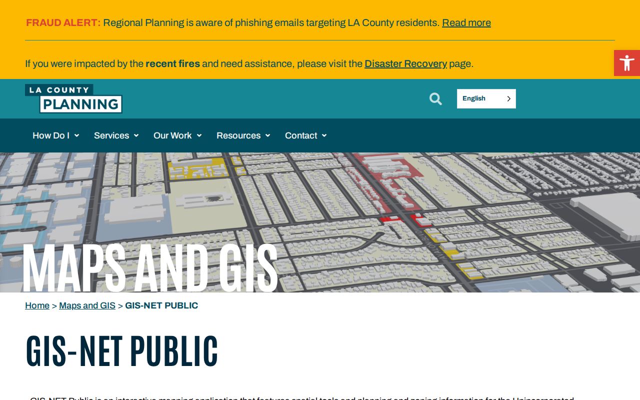
The map checks jurisdiction, not residents. A street can share county assessment and deed custody while its permit route differs. Preserve the returned jurisdiction before requesting an address-keyed file.
Apply Santa Clarita Voter Limits by Address
The exact form at LAVOTE requires last name in alphabetic characters, birthdate as MM/DD/YYYY, numeric house number, and numeric ZIP Code. It checks personal registration status, not a street or block. Help: 800-815-2666, option 2.
Other voter-file access is paid. The Election Information Section is at 12400 Imperial Highway, Room 2013, Norwalk. Mail requests include name, address, date of birth, signature, phone, and a self-addressed stamped envelope; appointments may take eight weeks. Search file: $5 per name/year; voter history: $6.75 per name; own certified registration: $1.50; another authorized or public copy: $6.75.
A countywide file is $146; a precinct, district, or city file is $54, plus $39 for an additional copy and a contract. Elections Code section 2194 limits use to permitted election, scholarly, journalistic, political, or governmental purposes. Qualifying court-order and Safe at Home voters are suppressed. No ordinary public address or street browse exists for Santa Clarita.
Note: A personal voter-status result cannot browse a street, and permitted files may suppress confidential addresses or contact information.
Use Santa Clarita Reverse Street Directories
The historical street directory layer is discrete, not continuous. Verified artifacts include 1923, 1929, 1957, 1958, and 1969 volumes; the 1969 volume includes codes and addresses. Books can offer a subscriber, resident, or business lead by name and address, but do not establish a current household.
If a volume is not online, ask a Santa Clarita library reference desk or the SCVHistory archive about local-history files and catalog leads. That can explain a gap without making an incomplete book complete.
Use the Santa Clarita Directory Book page for collection context, then return with old street name, community label, and legal description. A missing entry can reflect a volume gap, spelling, or changed address, not a definitive move.
What Santa Clarita Street Directory Cannot Show
Owners, deed parties, permit applicants, contractors, voters, directory subscribers, and occupants are different categories. Parcel data omits household members; a permit participant may be tied to a project; voter data has identity and statutory-purpose limits. Utility and DMV data are not block directories, and protected residents may be suppressed.
Lawful personal use. Use Santa Clarita address records for family history, parcel research, civic curiosity, reconnecting with someone known to you, or checking an official record. Do not use a street directory to stalk, harass, intimidate, impersonate, or harm anyone. California Penal Code section 646.9 addresses stalking.
When a source stops, respect its boundary. Verify with the custodian, keep dates, and report “not found in this search,” not no record.