
Santa Clarita ZIP Codes, Area by Area
The Santa Clarita ZIP map updated in December 2022 shows eleven postal areas touching the city or its immediate postal geography. “Station not verified” means no single post office was confirmed for that ZIP, not that mail service is absent.
| ZIP | Areas Covered | Post Office | Notes |
|---|---|---|---|
| 91321 | Newhall | Lyons, 23742 Lyons Ave, Newhall | Core city and community ZIP. |
| 91342 | Sylmar edge | Sylmar facilities | Touches the city-map geography, not wholesale Santa Clarita. |
| 91350 | Saugus / Santa Clarita label | Station not verified | USPS labeling cross-links 91354. |
| 91351 | Canyon Country | Canyon Country, 18336 Soledad Canyon Rd (facility listed as 91387-9998) | Facility ZIP label differs from the listed Canyon Country ZIP. |
| 91354 | Valencia / Santa Clarita | Station not verified | Core planned-community and northwest city geography. |
| 91355 | Valencia / Santa Clarita | Santa Clarita, 24355 Creekside Rd; Valencia, 25842½ Tournament Rd | Two listed facilities serve the postal identity. |
| 91381 | Stevenson Ranch / Newhall edge | Station not verified | Primarily edge or unincorporated geography. |
| 91382 | Santa Clarita / Valencia-Newhall Ranch | Station not verified | Newer western development geography. |
| 91384 | Castaic edge | Castaic | Primarily north and unincorporated; touches the official map. |
| 91387 | Canyon Country / Santa Clarita | Canyon Country, 18336 Soledad Canyon Rd | East city and Sand Canyon vicinity. |
| 91390 | Saugus / Santa Clarita | Station not verified | Large northern and rural postal geography. |
The rows are coverage clues, not a resident roster. Keep the ZIP, situs address, municipal jurisdiction, and legal description separate when a record search matters.
Note: The December 2022 map is dated, so a particular address still needs current USPS verification.
Santa Clarita ZIP Boundaries and City Lines
Santa Clarita postal boundaries are delivery geography, not municipal boundaries. Census ZIP Code Tabulation Areas are statistical approximations, and neither tool answers whether a parcel lies inside the city. Postal and community names cross incorporated and unincorporated places.
Santa Clarita incorporated in 1987 by combining Saugus, Newhall, Valencia, and Canyon Country at 39.79 square miles. More than 30 later annexations expanded the city. The official annexation map and table shows why city jurisdiction can change while a postal label stays the same.
No verified ZIP realignment year was located. Verify the current mailing result, then use the responsible agency. A ZIP cannot replace an AIN, legal description, or jurisdiction check.
Verify Santa Clarita ZIP Addresses
A direct address check in the USPS ZIP Code Lookup is the cleanest first step when a Santa Clarita ZIP label is in doubt. Use it before comparing a parcel or older directory. The result answers a mailing question, not city jurisdiction, ownership, or occupancy.
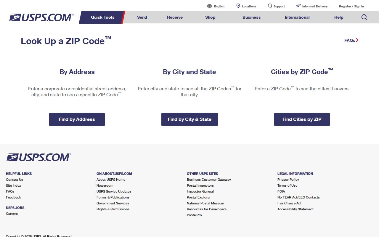
The USPS result gives the current postal starting point for the ZIP code directory. Record the returned ZIP and preferred city wording, and keep older wording separate.
The USPS facility detail page used for Santa Clarita verification is useful when a post office name or listed address needs a second check. It should be read with the coverage table, because the research confirms facilities for some ZIPs but leaves several station assignments unverified.
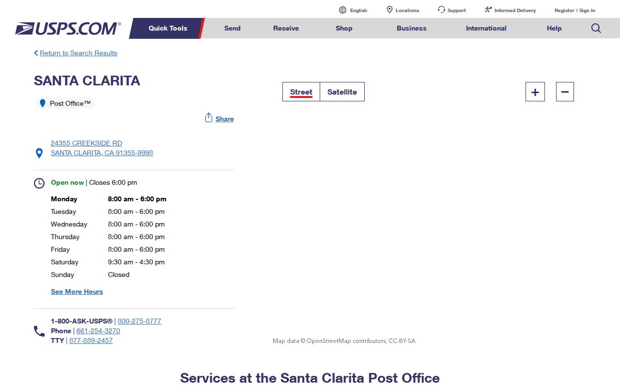
The facility listing separates a named counter location from a broad postal label. It does not prove that every related address is inside Santa Clarita.
Legacy Santa Clarita Names in ZIP Searches
Postal searches can look wrong when they use only the modern city name. Newhall, Saugus, Valencia, and Canyon Country remain useful because Santa Clarita is a late umbrella name in formal records. Older directories and maps may use a community name instead.
The 2023 USPS Postal Bulletin records preferred-city and ZIP relationships that are easy to mistake for borders:
- 91354 and 91350 are shown as a labeling relationship.
- 91355 and 91351 are shown as a labeling relationship.
- 91381 and 91321 are shown as a labeling relationship.
- 91387 and 91384 are shown as a labeling relationship.
- 91390 and 91350 are shown as a labeling relationship.
Those pairings describe mailing practice, not borders. Run a name under Santa Clarita and the relevant legacy community, then compare the address with the city map or parcel record.
The 2023 USPS Postal Bulletin is not a city annexation record. For jurisdiction use municipal material; for a parcel preserve the AIN and legal description.
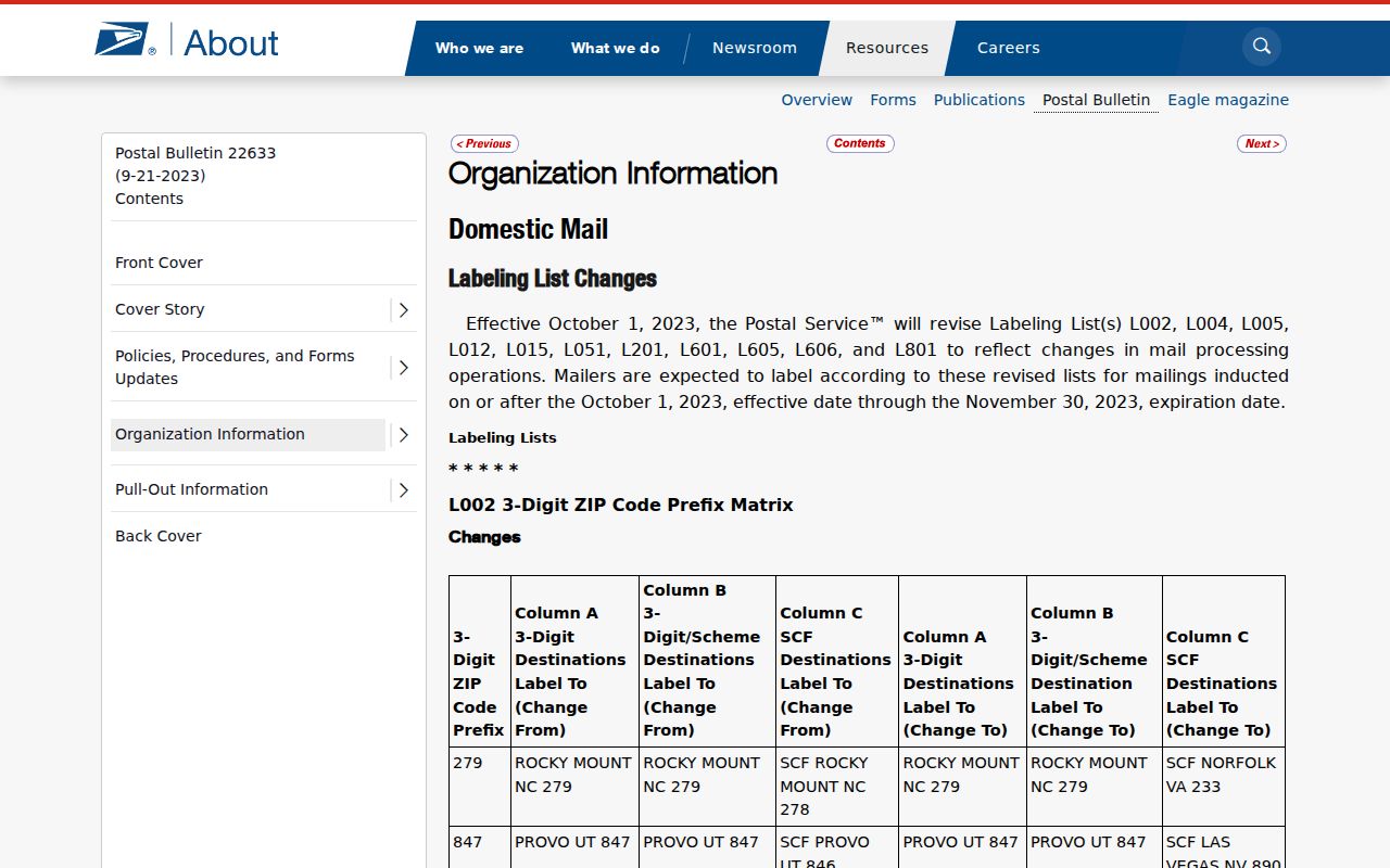
The bulletin puts label relationships in context, but a postal city is not proof of residence or municipal status.
Santa Clarita ZIP Leads in Unclaimed Property
The California Controller's unclaimed-property search is the researched portal with a ZIP field. It can return a prior owner name and reporting-address clues. A match is a lead only, not proof of current residence; a claim still requires identity documentation.
| Field Label | Type | Required | Options / Format Notes |
|---|---|---|---|
| Last or Business Name | Text | Required unless Property ID | Exact matches rank first; similar names follow. |
| First Name | Text | No | Narrows an individual search. |
| City | Text | No | Use Santa Clarita and legacy community names separately. |
| Zip Code | Text | No | Useful for postal-geography checks. |
| Property ID | Text | Alternative required | Enter alone when it is known. |
| Search | Button | Not applicable | Runs the query; selected results can be added to a claim. |
Try the ZIP with a last name or business name, then repeat with Santa Clarita or a legacy community name. Search and claiming are free, with no deadline to claim. The result is still not a substitute for a deed, assessor record, or current USPS check.
Note: An unclaimed-property match can reflect a reporting holder's old address, so treat it as a clue that needs an independent source.
Find Santa Clarita Residents by ZIP
A ZIP search works best as a staged workflow. Each source answers a different question, and none creates a complete Santa Clarita resident directory. Start with USPS, use the state tool for leads, then shift to parcel or custodian records.
- Verify the address. Run the street address through USPS and save the returned ZIP and preferred city wording. Do not infer the city line from the ZIP alone.
- Run a ZIP lead search. In unclaimed property, enter Last or Business Name and add City or ZIP. Use Property ID alone when it is known.
- Anchor a parcel. In the Los Angeles County Assessor Portal, search by exact address or ten-digit AIN. The alternative mode is Assessment Legal Description, not a public owner-name search.
- Check the map. Open the county GIS parcel viewer to compare the site, ZIP, adjacent parcels, jurisdiction, and legal description. The map supplies parcel context, not resident names.
- Use voter records only through their permitted path. A personal status check requires last name, birthdate, house number, and ZIP. It cannot browse a Santa Clarita street or enumerate a ZIP's voters.
- Move to the street level. Once a ZIP narrows the address, use the Santa Clarita street directory workflow for address-keyed records instead of treating the ZIP as the final answer.
The Los Angeles County voter-status check requires Last Name, Birthdate in MM/DD/YYYY format, House Number, and ZIP. Help is (800) 815-2666, option 2. It validates the requester's own registration, not a public name browse.
Authorized voter-file access is separate. The Election Information Section at 12400 Imperial Highway, Room 2013, Norwalk accepts written requests with requester name, address, birthdate, signature, phone, and a self-addressed stamped envelope; appointments may run eight weeks. The fee schedule lists $146 for a countywide file, $54 for a precinct, district, or city file, and $39 for an additional copy. Use requires a permitted purpose under Elections Code section 2194 and 2 CCR section 19003. The county voter-data page explains the contract path.
Note: A personal voter-status result confirms registration details for the requester, not every resident associated with a ZIP or address.
Santa Clarita Parcel Checks Beyond ZIP
The Los Angeles County Assessor Portal is a parcel search, not a ZIP code directory. Its tabs are Search by AIN or Address and Search by Assessment Legal Description. Exact address or a ten-digit AIN works best. Broad queries may cap at 501 results; no public owner-name search, owner identity, or mailing address is offered online.
Preserve the AIN, then compare site address, ZIP, tract or lot, and legal description. It keeps the same land unit attached when postal wording or annexation status changes.
The Los Angeles County Assessor GIS adds a free map. Search by address or AIN and inspect adjacent parcels. A pop-up can connect to detail, but it does not add owner or occupant names.
ZIP Terms for Santa Clarita Searches
Each code represents a different kind of geography. These terms keep a mailing label from being mistaken for a parcel, person, or city line.
- ZIP code
- A USPS delivery construct used to sort and route mail. It describes postal geography, not a municipal boundary.
- ZIP+4
- Four extra digits added to a five-digit ZIP to narrow delivery routing. It does not identify a resident or parcel boundary.
- PO-box ZIP
- A ZIP assigned to mail sent to post-office boxes at a facility. It can identify box service without locating a person's home.
- Unique ZIP
- A ZIP assigned to one large organization, institution, or high-volume address. It is not proof every addressee lives there.
- Carrier route
- An operational delivery grouping inside a ZIP. It organizes mail service and is not a public resident roster.
- ZCTA
- A Census statistical approximation of ZIP geography, not an actual USPS delivery boundary or city limit.
Santa Clarita Records When ZIPs Mismatch
When a ZIP, postal city, and municipal label disagree, check land by parcel identity. The Los Angeles County Registrar-Recorder/County Clerk real-estate records page explains that there is no complete public online deed index or image archive. The counter at 12400 Imperial Highway, Norwalk provides free appointment viewing: 1851-1957 on the lower level and 1958-present on the second floor. Its alphabetical index uses name and recording year, not street address or APN.
The RR/CC phone line is (800) 201-8999, property recording option 2 and recorded records option 3, but staff do not perform telephone searches. A mail request lists document title, names, and recording year or years; send it to RR/CC Real Estate Records, PO Box 1130, Norwalk, CA 90651-1130, with a check or money order. The researched turnaround is 20 working days. An online copy-order route is not a deed index.
For a city map, annexation record, permit file, or other existing municipal record, use the Santa Clarita City Clerk public-records request channel. A CPRA request should describe identifiable records. The initial determination is generally within ten calendar days, with up to fourteen additional days in unusual circumstances. CPRA does not require a new ZIP-based resident list. Older naming and map questions can move to the Santa Clarita Public Library catalog, SCVHistory archive, or California State Archives, which are historical aids rather than current ZIP authorities.
Santa Clarita ZIP Research Limits
The ZIP code directory has a clear edge. No authoritative ZIP realignment year, complete post-office-to-ZIP carrier assignment, or citywide E911 readdressing project was located. Several station assignments remain unverified, so current address verification belongs with USPS.
A ZIP result has limited meaning about people. Unclaimed property can provide a prior reporting address, the Assessor can identify a parcel by address or AIN, GIS can show mapped land, and voter status can validate the requester's own registration. None is a complete current resident list, and protected addresses remain outside ordinary searches.
When evidence conflicts, preserve the postal ZIP, preferred city, situs address, AIN, legal description, source date, and jurisdiction. That keeps an old label from becoming a false claim about where a person lives.
Note: “Not found” can reflect naming, coverage, confidentiality, a changed address, or an office-only index rather than no underlying record.